Green Forum

Natura 2000 Biogeographical Regions

Since 2012, the European Commission has overseen the Natura 2000 biogeographical process to assist Member States and key stakeholders to manage Natura 2000 as a coherent ecological network.

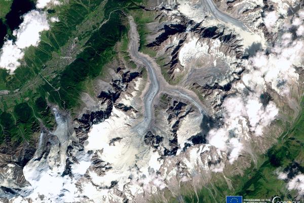
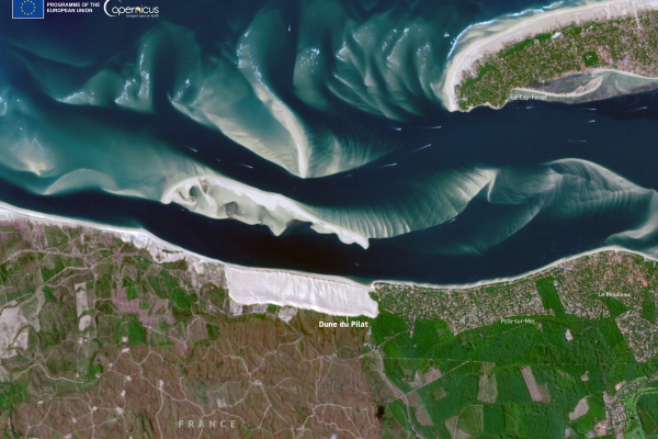
The biogeographical regions

The European Union has nine terrestrial biogeographical regions, each with its own characteristic blend of vegetation, climate and geology. Sites of Community Importance are selected according to each region on the basis of national lists submitted by each Member State within that region. Working at this level makes it easier to conserve species and habitat types under similar natural conditions across a suite of countries, irrespective of political and administrative boundaries. Together with the Special Protection Areas designated under the Birds Directive, the Sites of Community Importance selected for each biogeographical region make up the ecological Natura 2000 network which spans all 27 countries of the EU.
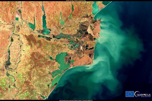
 

Terrestrial regions

Image of the day - August 2024

Alpine regions have a rich and diverse biodiversity. 105 habitat types, 97 plants and 134 animal species listed in the Habitats Directive are found in the Alpine region. Almost two thirds of the plants on the European continent are present here. Habitats and species alter rapidly with altitude, and the complex topography and differing exposures create micro-climates.

Image of the day - October 2024

The Atlantic Region exhibits less biodiversity than other regions but has an abundance of life. The oceanic climate penetrates far inland bringing mild winters, cool summers, and moderate rainfall throughout the year. The Gulf Stream brings warm currents all year round and a rich supply of nutrients, creating an ideal environment for a wide array of marine organisms.

Image of the day - February 2021

The humid coastal air currents from the Black Sea moderate the continental weather, with milder winters and cooler summers along the coast. Behind the shoreline, a series of coastal lakes, marshes and lagoons act as stepping stones for wintering birds. The Danube Delta wetland is the second largest in Europe, extending over 4,500 km² and hosting an incredible diversity of rare plants and animals

Image of the day - February 2023

The Boreal Region is a mosaic of coniferous forests, mires and lakes. It includes the coastline and islands around the Baltic Sea and Gulf of Bothnia. Along the coast, bedrock archipelagos intermingle with low-lying brackish fens and meadows, providing ideal nesting grounds for hundreds of thousands of migratory birds. Forests cover around 60% of the region, but the majority, used commercially, are of reduced conservation value compared to the original natural old-growth forests (5–10%).

City of Essen, Germany, European Green Capital 2017

The Continental Region spans a quarter of the EU, stretching from central France to Poland and Romania, extending to the Ural Mountains in Asia. It features flat landscapes in the north, hilly terrain in the south, and significant floodplains. Major rivers like the Danube and Rhine connect regions economically. Despite extensive agricultural transformation, it retains rich biodiversity, sharing species across various biogeographical zones.

Image of the day - November 2024

The Macaronesian region, comprising the Azores, Madeira, and the Canary Islands, is volcanic and features dramatic landscapes, including calderas, mountains, and cliffs. Despite making up only 0.3% of the EU, it hosts 19% of EU habitat types and 28% of plant species. Its seas are rich in wildlife. Tourism is the main industry in the Canaries, while traditional farming is declining, replaced by tropical crops for export.

Image of the day - February 2025

The Mediterranean basin stretches from Portugal to Lebanon and from Italy to Morocco. Its climate features hot, dry summers and cool, humid winters, with occasional storms and winds like the Sirocco and Mistral. The region hosts up to two billion migrating birds annually. The Mediterranean Sea is home to diverse marine life, including endemic species, with 8-9% of the world’s marine creatures found in its waters, especially around Posidonia beds.

Image of the day - September 2024

The Pannonian Region is a flat alluvial basin bordered by the Danube and Tisza rivers, surrounded by the Carpathians, Alps, and Dinarics. Its sheltered position influences its unique climate, creating a diverse mosaic of vegetation and dramatic thunderstorms. This region hosts a high level of biodiversity, including many endemic species. It is also crucial for birds, with hundreds of thousands of migrating waterfowl, including rare species like the lesser white-fronted goose and spoonbill.

Smart farming - Ferme du Plein Air

The Steppic Region covers less than 1% of the EU, and is found only within Romania.
It is characterised by low-lying plains, hills and plateaus, and is crossed by the Danube and other rivers, which create floodplains amidst the arid landscape.
The vegetation is composed mainly of grasses and herbaceous plants. The rich soils are very fertile meaning the vast majority of the area has been turned into arable land growing cereals, sugar beet, sunflower and vegetables.

Marine areas

in 2022 the terrestrial and marine elements were split, and a new biogeographical process in the marine regions was formed. 

Atlantic & Macaronesia
Baltic
Mediterranean & Black Sea

The biogeographical process

The Natura 2000 biogeographical process included work carried out under the Biodiversity Strategy, and in particular the pledge and review process for targets for improving conservation trends for protected species and habitats, as well as for the targets on terrestrial protected areas.

The process was divided into three steps for each biogeographical region:

Step 1: introductory meetings to plan next steps and specify the pledges that each Member State must submit.

  • a list of species and habitats for which they intend to achieve a strong positive trend by 2030, covering at least 30% of all species and habitats not currently in favourable/secure status
  • an explanation of the criteria that have been used for selecting the species and habitats
  • the measures they intend to put in place to ensure the achievement of the strong positive trends for each of the species and habitats
  • the measures they intend to put in place to avoid deterioration for all other species and habitats not on the list.

Step 2: (between 2023 and June 2024): face-to-face biogeographical region-level seminars to discuss and review the initial pledges made by Member States. National pledges may then be reviewed on the basis of the conclusions of those meetings.

Step 3: one virtual meeting to assess implementation in view of an interim evaluation of progress.